How We Got Here
Franklin Street didn’t always look like it does today.
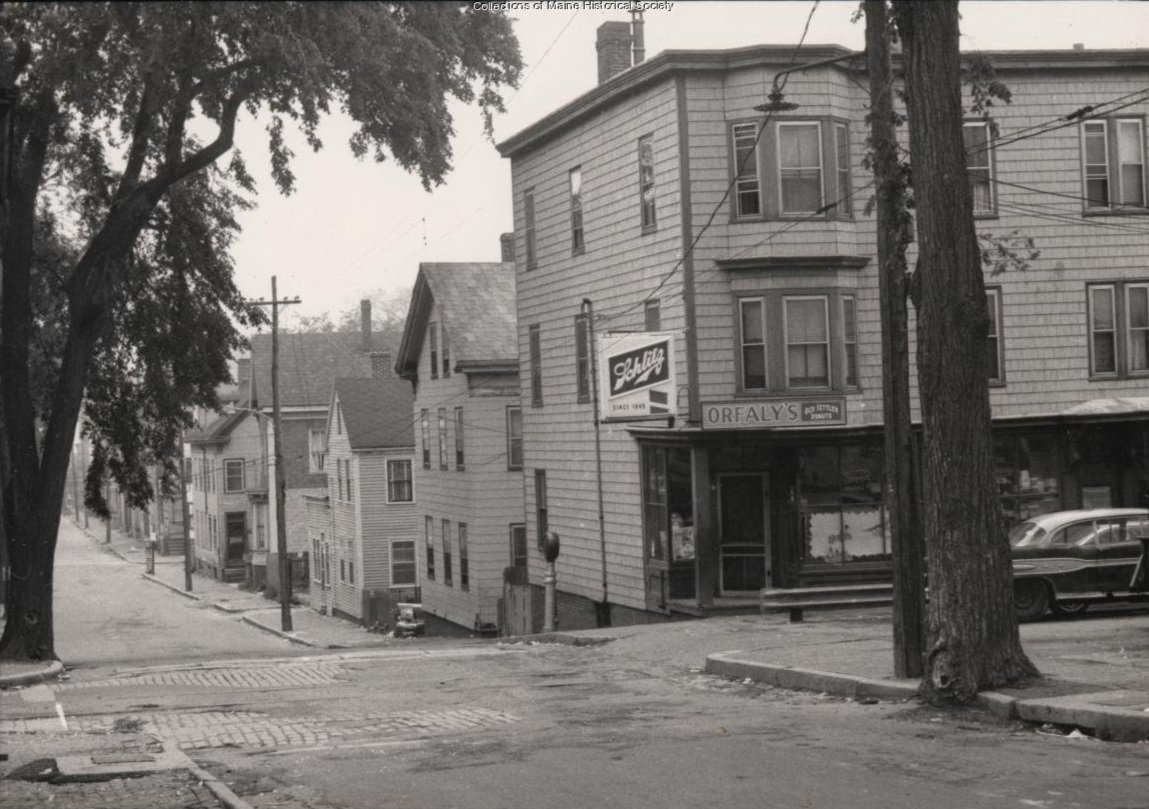
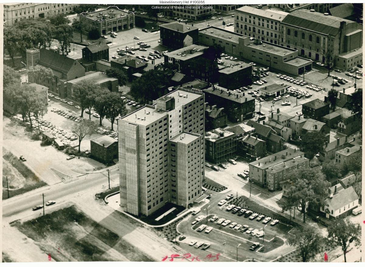
In the first half of the 1900s, Franklin Street was a typical north-south two-lane street, much like many others in the City of Portland. The neighborhoods surrounding it were densely populated, many of them with recent immigrants. With the advent of urban renewal in the 1960s, however, Franklin Street and the abutting areas were identified as the preferred route for moving traffic between the new Interstate 295, downtown Portland, and the waterfront. The razing of the neighborhood around Franklin Street began soon after, resulting in the demolition of approximately 100 structures and the displacement of families and businesses along the entire three-quarter-mile corridor. East-west through streets, including Lancaster, Oxford, Federal, and Newbury Streets, were dead-ended. And the Franklin Street we know today, with its vehicular mobility-focused street design, was the end result.

Beginning in the late 2000s, the City of Portland and advocates began to rethink Franklin Street, looking for a way to better connect the neighborhoods on either side and more effectively meet the multimodal transportation needs of the community. The most recent plan for Franklin, the Franklin Street Feasibility Study, was completed in 2015. It recommended a design concept that would realign the road and reduce its footprint, improve pedestrian infrastructure, add bicycle and streetscape features, and reestablish several cross streets to reconnect adjacent neighborhoods. The concept was unanimously adopted by the City Council on July 20, 2015.
In recent years, recognizing changes in the immediate context, there has been renewed focus on Franklin Street. Development has occurred along the street’s southern end and restoration work has occurred at Lincoln Park. The region’s Vision Zero Plan identified Franklin Street as a critical safety corridor due to its high incidence of crashes and the Gorham-Westbrook-Portland Rapid Transit Study selected the southern end of Franklin Street as part of a future alignment for high quality rapid transit service.
Building on this work, in 2024, the City of Portland and MaineDOT began the process to initiate Reimagining Franklin Street. This effort will consider the best features from the 2015 plan, apply today’s standards for multi-modal street design, and address transportation and land use in tandem. The end result will be a final plan for Franklin Street, one that paves the way for a new, once-in-a-generation investment in this critical element of the City’s fabric.


Photo/image credits: Maine Memory Network, Portland Press Herald, Franklin Street Feasibility Study, Greater Portland Council of Governments, and WSP Inc.
For additional background, resource materials, and a snapshot of the process begun in 2023 to reinitiate the planning for the Franklin Street project, click here.